


What's passing overhead in the Ada sky?
By Monty Siekerman
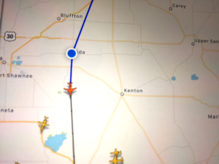
“Up in the sky, look: It's a bird. It's a plane. It's Superman!” You’ve heard that quote many times. Ever wonder what that plane is flying over Ada as you look up into the sky? Now you can know.
There’s an app for that. It tells you anywhere in the world, 24 hours a day what planes are in the sky. Right now there is an airplane near SR 309 just north of Alger—it’s a 737 flying at 34,000 feet, at 363 knots per hour (418 mph), that left Boston at 5:55 and will arrive in Phoenix at 7:17.
The map of the world is littered with hundreds of airplanes at any one time. The app usually identifies where a plane started from, its destination, the path the plane is taking, where along the path it currently is located, when it left, when it is to arrive, the type of plane, its speed and altitude, its longitude and latitude, and more.
So, if you look up and see an airplane overhead, you’ll know lots about it.
If a friend is flying, you can keep track of the plane’s progress through the sky.
And there is much more you can learn about the planes flying throughout the world, if you want to spend a few bucks on an upgrade. For example, you can see the plane in the air and what the ground looks like underneath, live, in real time. There may be mountains, lakes, deserts, cities beneath the plane.
How to get the free app: Go to your App Store icon, type in FlightRadar24.
Happy landing!
